
Day 14 : Chiappera to Rifugio Pian Melezè
| Previous: | Next: | |
| 13 : Chialvetta to Chiappera | 15 : Rifugio Pian Melezè to Rifugio Bagnour |
| Distance: 16.2 km | Total time: 00:00:00 |
| Altitude gain: 1150 m loss: 1000 m | ( of which 00:00:00 resting time ) |
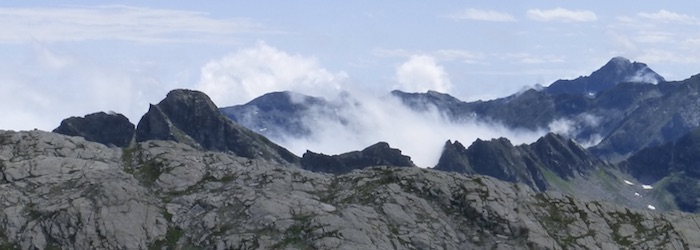
From Chiappera, follow the gravel road up into the valley, past Rifugio Campo Base. At the end of the valley, take the track up to Colle di Bellino. It's quite a climb, but great views await. After the pass, you meet a stream that has carved a kind of mini-canyon into the high valley. Further down, the path follows the broad green valley, which has a few summer farms and/or holiday houses. Follow the signs to the hamlet of Sant Anna. From there it is a short walk along the road to Rifugio Pian Melezè.
{joomplucat:15 limit=12|columns=4}